Campaign operating system
Real-world campaign infrastructure,
from planning to proof.
TraceReach helps teams plan field campaigns, coordinate placements, verify what happened on the ground, and read the response by location, asset, team, and partner.
Coordinate your Posters Transit Ads Billboards Street Furniture Transit Wraps

 rov.to
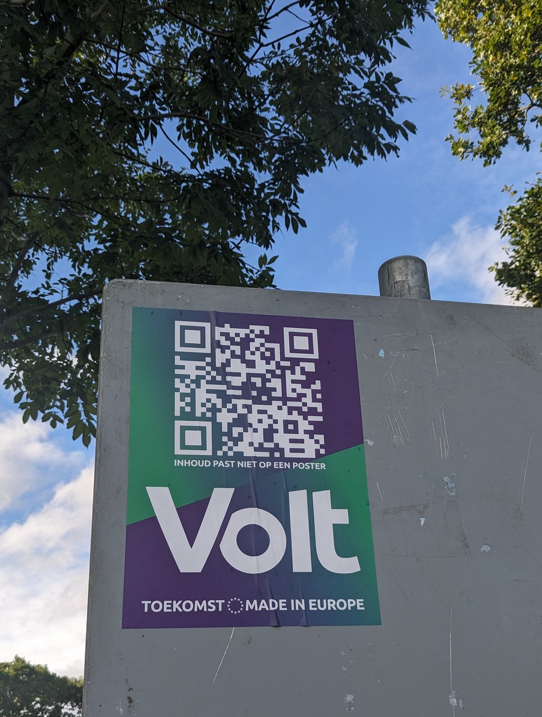
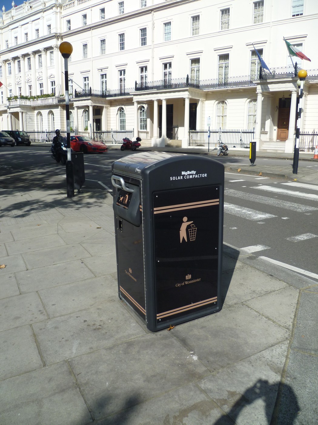

Street photos: Poster Boy NYC (CC BY 2.0), Jakub Zerdzicki (Unsplash), Donald Trung (CC BY-SA 4.0), Philafrenzy (CC BY-SA 4.0), Nurken (CC BY-SA 4.0)
Run the whole field loop from one operating record.
Plan the campaign, assign the assets, verify the work, and read the engagement that follows.
campaigns, assets, and coverage
teams, drops, and partners
GPS photos and field logs
compare results and report out
See it in motion
Watch Studio run a live campaign.
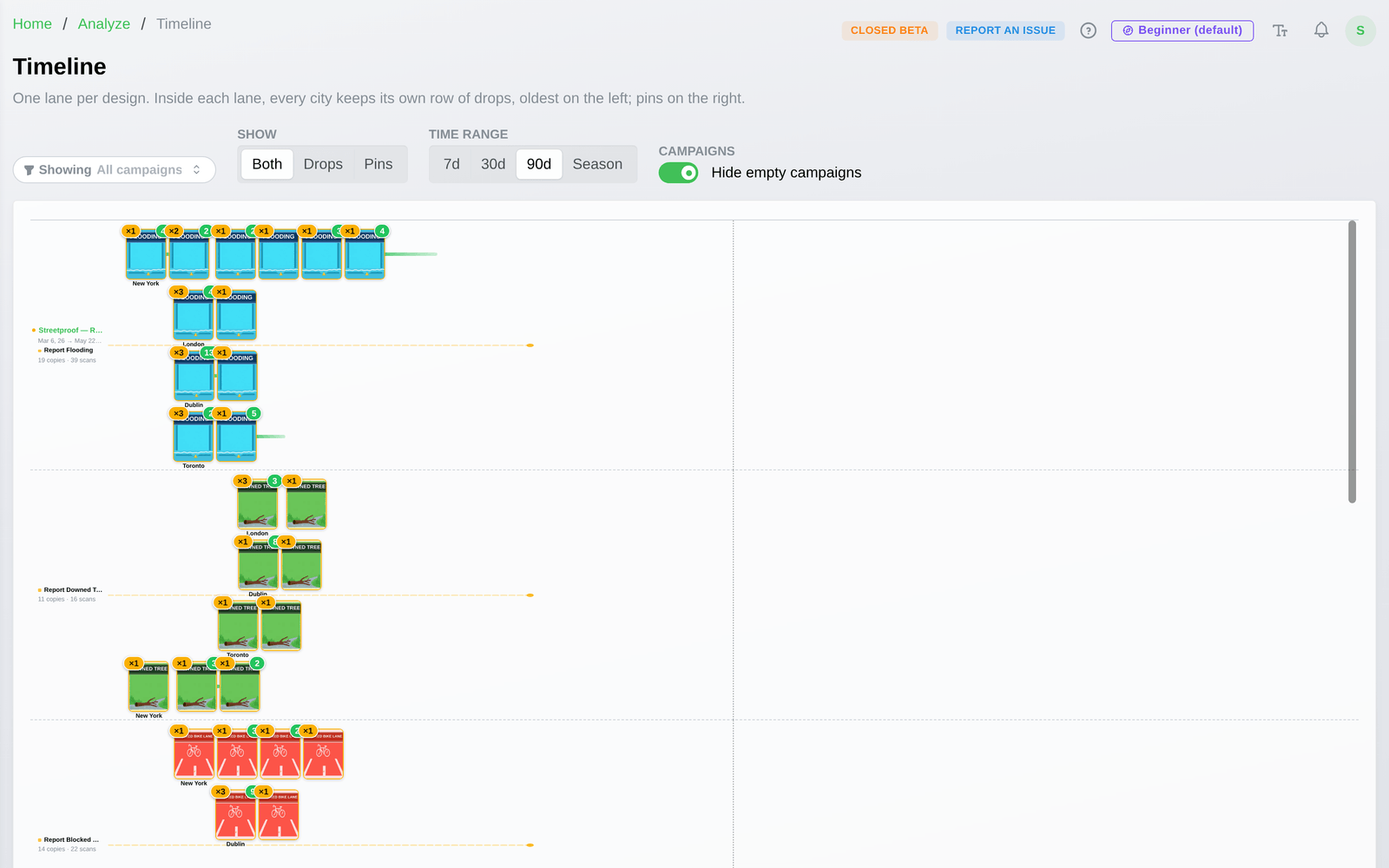
Plan ahead and see what's slated before it goes up, keep a dated, located, photographed record of every drop, watch coverage build over time, design the page each scan lands on, see which spots outperform on the heat map, read which designs get scanned, and take in the whole campaign at a glance.
See it in TraceReach Studio
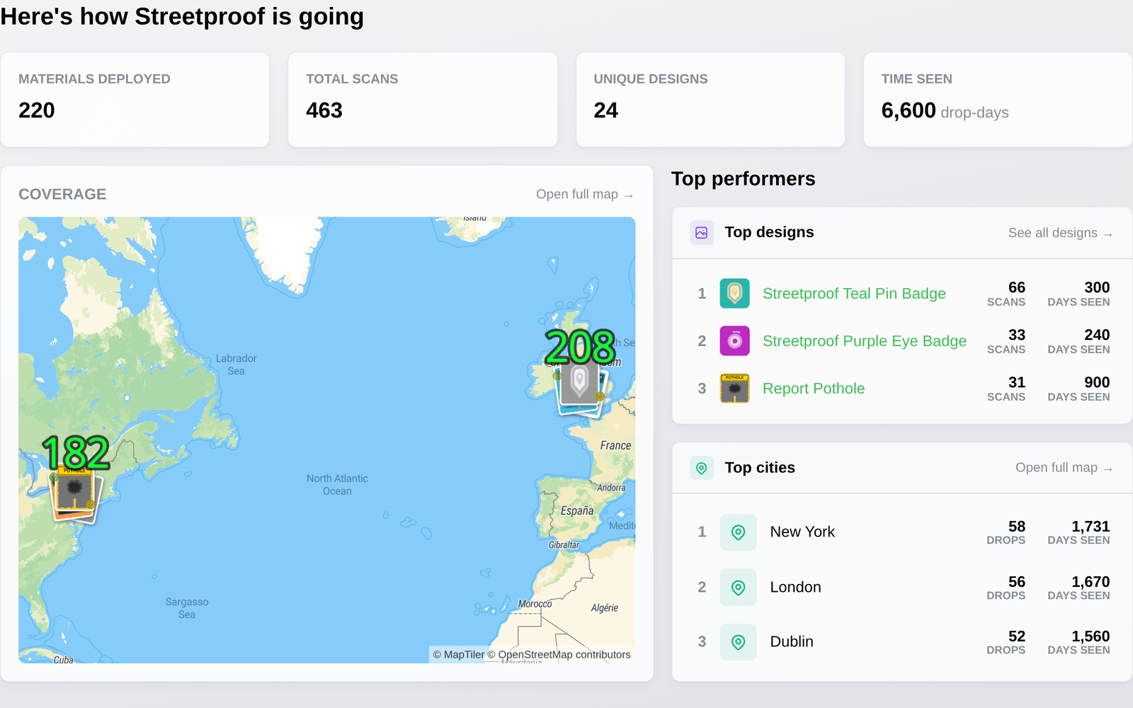
Read your whole campaign at a glance.
Compare campaign activity across assets, places, teams, partners, scans, visits, and page actions.
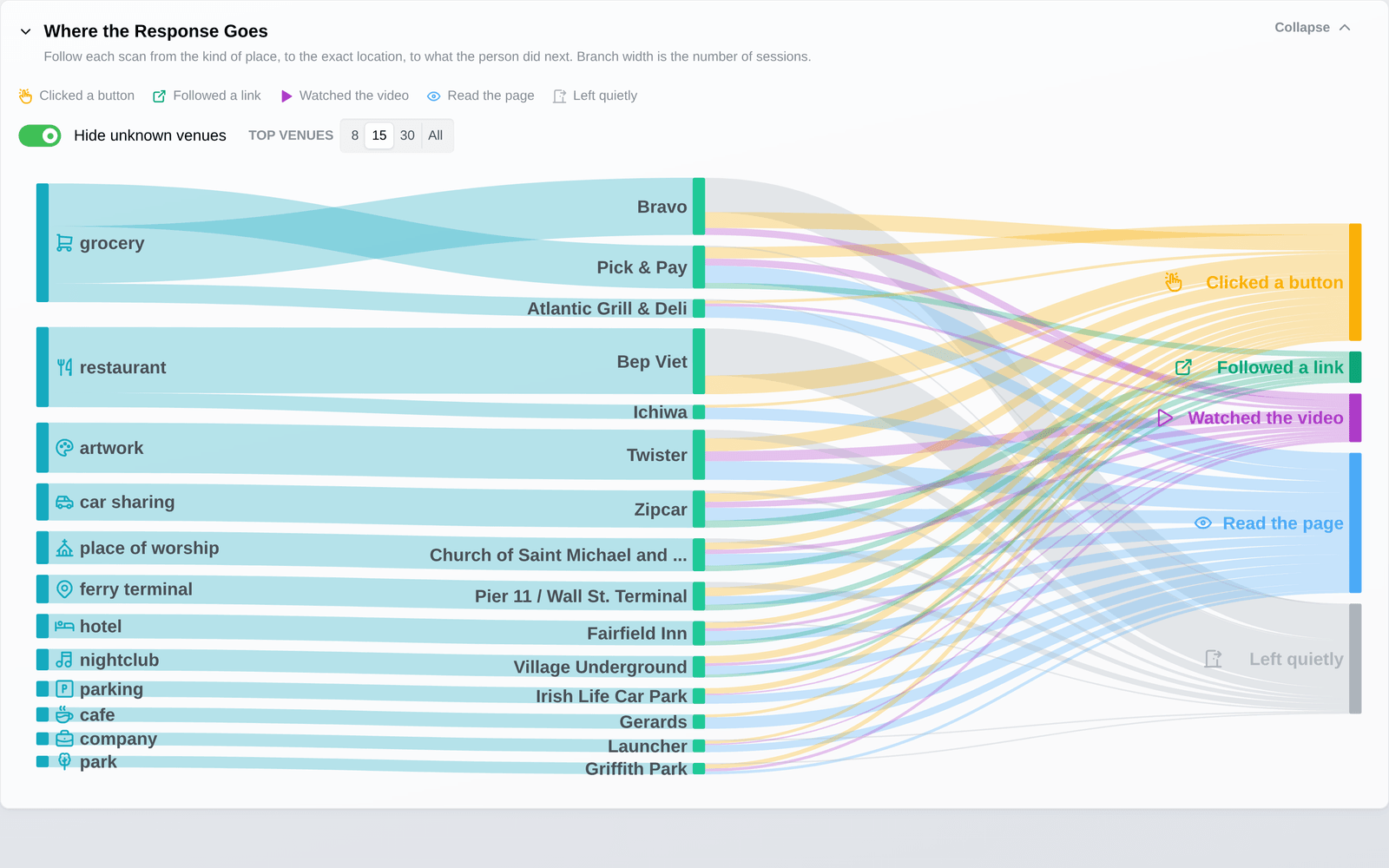
From the Place to the Action
Follow engagement from location to action.
TraceReach ties each scan, visit, and action back to the campaign, asset, partner, team, location type, and the pin behind it.
Branded landing pages
Build the page each field interaction lands on.
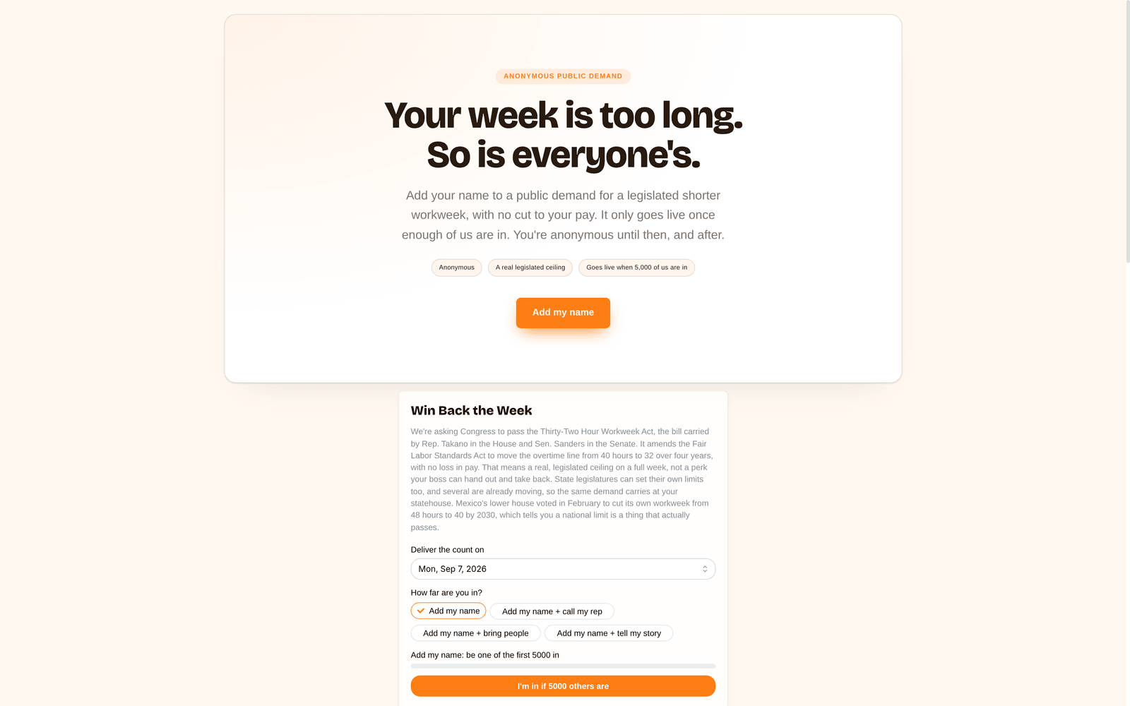
Build a themed page from designed sections like a hero, feature grid, stats, and FAQ, then set its colors to match the campaign. Drop in blocks the page runs by itself: a threshold pledge that stays private until enough people add their name, a poll that branches on the answer, or a video with its own replay readout. TraceReach measures what people do after they arrive.
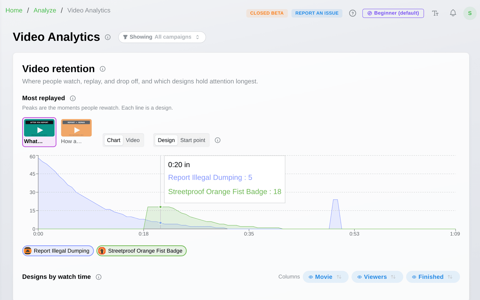
Video on your pages
See the moment people replay.
Put a video on a campaign landing page and read how people watch it. The replay curve shows how far they get, where they drop off, and the moment they rewind. Compare videos, pages, assets, and locations to see what holds attention longest.
Branded profiles
A public homepage for your org.
Your branding, mission, links, and live campaigns on one public page. It is the face partners, volunteers, and the press see when they look you up.
Field execution built into the campaign plan.
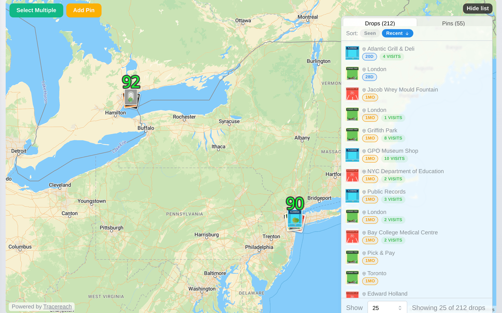
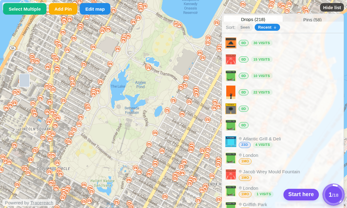
TraceReach starts before the team leaves: campaigns, assets, assignments, partners, and coverage goals all live in one record. As the work happens, GPS-photo proof, short-link activity, scans, visits, and outcomes fill in the same operating view.
Plan before the team heads out
See the city before the team heads out.
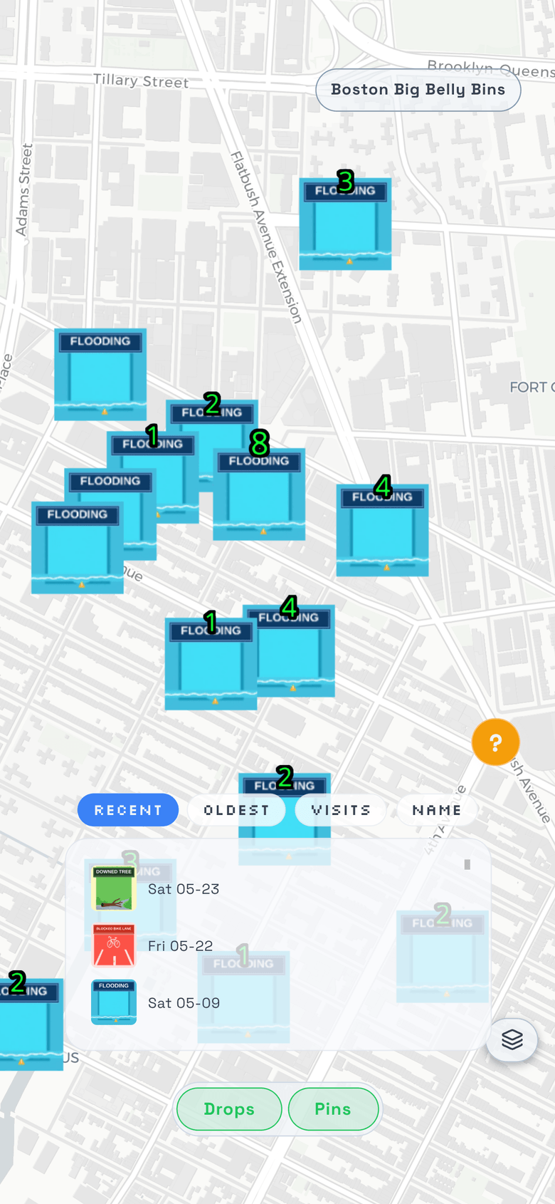
Streetproof adds public map layers for any city, bus stops, benches, bike racks, and notice boards, so the team can plan drops around the places people already pass.
The map is the live surface where the plan, assignments, field proof, scan attribution, and response become visible together.
What sets us apart
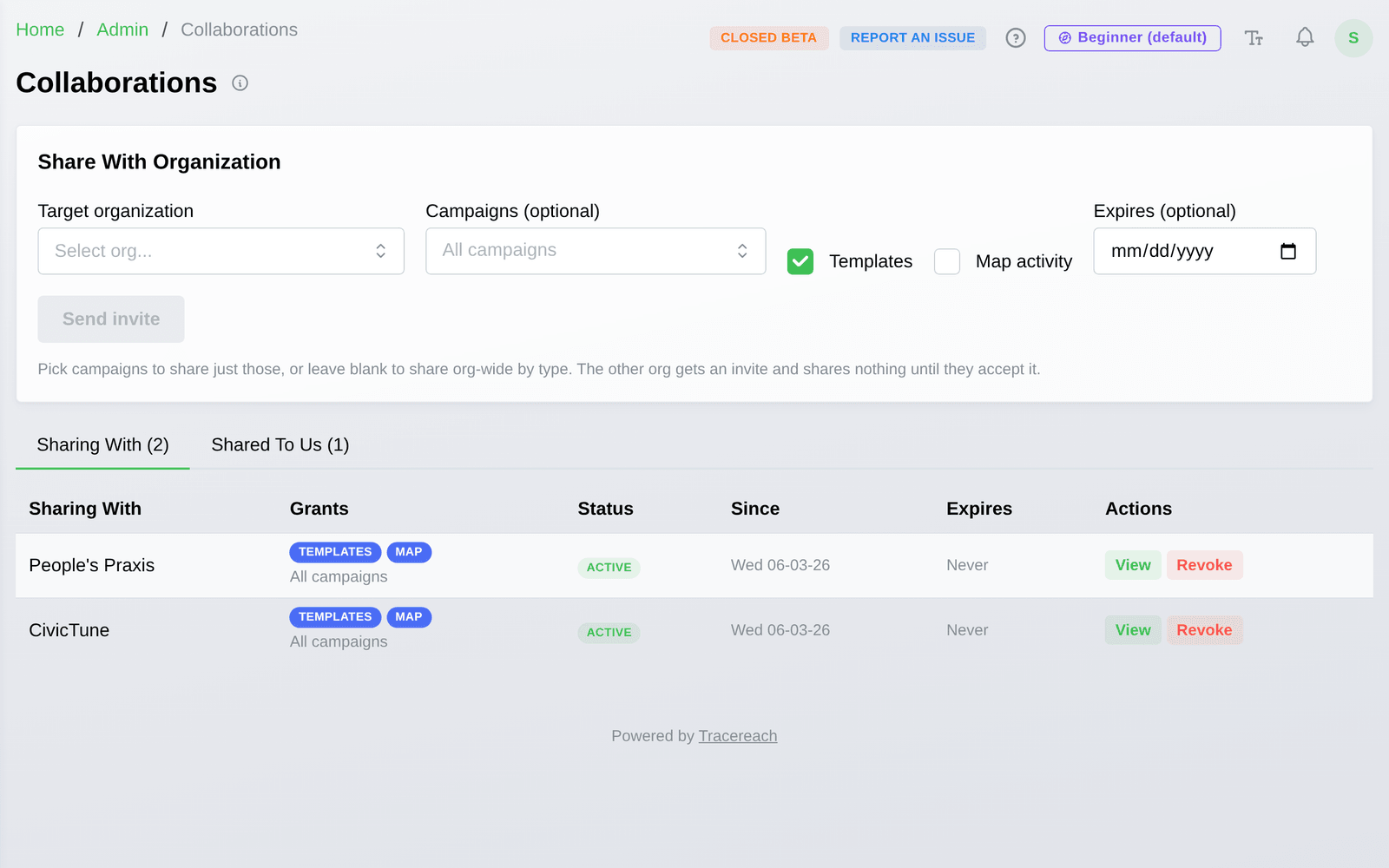
Collaborate across organizations.
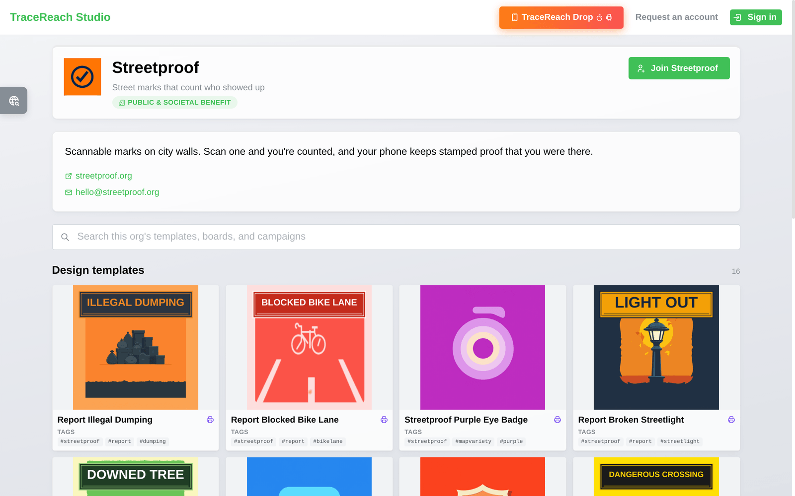
Share your designs, campaigns, and live map activity with partner organizations. Coalitions, chapters, and allied groups work from one source of truth, each keeping its own data.
Grant or revoke access per organization, per resource. No re-uploading art, no exporting spreadsheets.
Your tools
TraceReach Studio + TraceReach Drop.
Campaigners plan, assign, analyze, and report in Studio. Field teams log proof and Drops in Drop.
TraceReach Studio
Plan campaigns, assign assets, coordinate partners, compare results, and package reports from one operating record.
TraceReach Drop (iOS & Android)
Log Drops, canvass stops, handouts, and field activity as they happen. Each record carries GPS-photo proof tied to the spot.
When a location goes quiet, that tells you something.
TraceReach flags hot spots, cold spots, and shifts in the response across locations, assets, teams, and campaigns, so the next plan starts from evidence instead of habit.
Your data, your hardware
Your campaign data stays off Google, Amazon,
Microsoft, Apple, and Meta.
Your database, sign-ins, photos, maps, and URL redirects all run on one server we rent in Germany. We do measure how this site gets used, with our own analytics on that same server, under our own domain. That usage data never leaves to Google Analytics or any ad or data-broker company. This page loads its fonts and images from our domain too, so open your browser's network tab and check: it loads from us, not from big tech.
Self-hosted database
PostgreSQL on dedicated European hardware. Not a managed cloud instance.
OpenStreetMap
Maps and geolocation from the open-source community. No Google Maps API.
Photos on our server
Your field photos stay on our filesystem. No S3, no cloud storage buckets.
Most platforms can’t say this. Most don’t even try. We built the core product stack without big tech dependencies because the organizations who use TraceReach shouldn’t have to wonder where their field data ends up.
Full data sovereignty details| Feature | Generic QR tools | TraceReach |
|---|---|---|
| Short URLs & custom slugs | ||
| Dynamic QR codes, editable after print | ||
| Scan analytics per link | ||
| Campaign grouping | ||
| Redirect rules & tags | ||
| Asset and design comparison | – | |
| Hot-spot and dead-zone detection | – | |
| GPS-locked photo proof with geofence | – | |
| Live campaign map | – | |
| Visitor actions per design | – | |
| Assignments, coverage maps & leaderboards | – | |
| Offline capture with auto-sync | – | |
| Code-based onboarding & photo review | – | |
| Cross-org campaign sharing | – | |
| TraceReach Drop (iOS & Android) | – |
How it works
Plan, assign, coordinate, place, prove, track, analyze, compare, and improve.
Plan the campaign
Create the campaign, organize assets, generate short links, define coverage goals, and assign the work before anyone heads into the field.
Verify DropsCoordinate the field
Teams place assets, log canvass stops and Drops, capture GPS-photo proof, and sync the work back to Studio.
Analyze EngagementWatch it become visible
The live map shows the campaign plan, field activity, proof, scans, visits, and short-link activity by location and asset.
Analyze EngagementImprove the next run
Compare campaigns, teams, partners, locations, landing pages, and videos so the next assignment starts from evidence.
Campaign IntelligenceBuilt by TraceReach LLC; real-world campaign infrastructure for planning, proof, attribution, analytics, comparison, and reporting.